The Temple of the Resurrection of the Christ or Temple of the Christ, as it is mostly known today, was
The castle of Ioannina was the work of the Ottoman provincial ruler of Epirus, Ali Pasha, from the late 18th
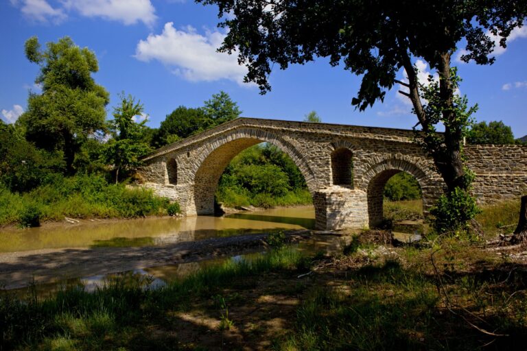
Ziakas Bridge is a double-arched Bridge and it was built in the 19th century over the river Velonia. It stands
Three large halls and a wide courtyard, functioning as an open-air exhibition place for sculptures, complete the space, where the
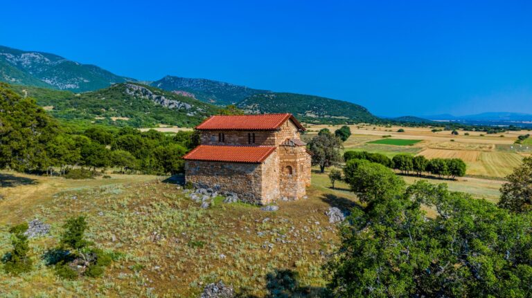
Near Aiani, we find the basilica of Agios Dimitrios, which is a 13th-century monument. Its wall-paintings are dated to 1593.
The impressive beaches of Vourvourou- “Karydi” (walnut) beach is the best known- gather hundreds of tourists every year, because of
The road after Therma runs next to the sea and, after 8 kilometres, one reaches the Killer’s Tower. The tower,
The circular Laskaras for at the top of the hill called Tourkovouni, was built by Ali Pasha in 1807, to